India is witnessing a sharp change in weather conditions as the monsoon pattern shifts and winter gradually sets in across many regions. Fresh snowfall in several mountainous areas has increased the chill in the plains, while a combination of fog, cold winds, and light rain is affecting day to day life in many states.
Northern states such as Uttar Pradesh, Haryana, Bihar, and parts of Delhi NCR have started experiencing winter-like conditions. People have begun using warm clothes in the mornings and evenings, and visibility has reduced in several places due to dense fog. At the same time, the Indian Meteorological Department has issued important rain alerts for southern and island states, while also tracking snowfall in Jammu and Kashmir, Himachal Pradesh, and Uttarakhand.
Changing Weather Pattern Across India
A noticeable shift in weather is being reported from many parts of the country. In the northern plains, the effect of snowfall in the higher reaches has started showing up as a drop in temperature. People in Uttar Pradesh, Haryana, and Bihar are waking up to colder mornings and pleasant yet chilly evenings. Warm clothing, which was kept aside after the last winter, is slowly returning to regular use.
In the northeastern states, cold winds are making the weather feel even cooler than the actual temperature suggests. This cold wave type condition is more evident in the early hours of the day and late evenings. At the same time, cloud cover and mist are also impacting comfort levels in several locations.
Monsoon And Winter Weather Update: Quick Summary
Key Point |
Details |
|---|---|
Main Update |
Change in weather pattern with rain, fog, and snowfall in many areas |
Cold Wave Condition |
Increasing chill in Uttar Pradesh, Haryana, Bihar and North East |
Rain Alert States |
Tamil Nadu, Kerala, Karnataka, Andaman and Nicobar Islands, Lakshadweep |
Light Rain Possibility |
Maharashtra, Goa, Telangana |
Snowfall Expected |
Higher reaches of Jammu and Kashmir, Himachal Pradesh, Uttarakhand |
Delhi NCR Situation |
Dense fog, increased cold, AQI around severe category |
Visibility Issue |
Dense fog in Delhi NCR and western Uttar Pradesh |
Official Weather Website |
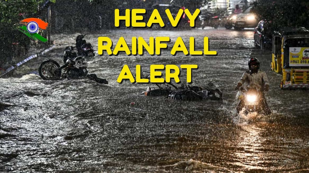
Heavy Rain Alert For Southern States And Islands
The Indian Meteorological Department has issued a strong alert for heavy rainfall in a few southern states. As per the forecast, parts of Tamil Nadu, Kerala, and Karnataka are expected to receive heavy showers in the coming hours. This rain activity is associated with moist winds from the sea and changing pressure conditions.
Along with this, a warning has also been issued for moderate rain accompanied by thunderstorms in the Andaman and Nicobar Islands and Lakshadweep. These island regions are often impacted by changing monsoon and cyclone related patterns, so residents and fishermen need to stay updated with the latest advisories.
Isolated light rain is also possible in some pockets of Maharashtra, Goa, and Telangana. While the intensity of rain in these states is not expected to be very high, it can still affect local traffic, outdoor events, and day to day activities.
Increasing Cold In Central And Eastern States
In states like Bihar, Jharkhand, and Madhya Pradesh, cold conditions are expected to intensify gradually. As cold winds from the north move toward the central and eastern parts of the country, both minimum and maximum temperatures are projected to drop.
Residents may feel a combination of cool breeze during the day and a sharper chill at night. Agricultural activities, especially early morning field work, could be influenced by the drop in temperature and the presence of fog or mist in some regions.
Weather And Pollution Update For Delhi NCR
Temperature And Fog Conditions
According to the Meteorological Department, Delhi NCR is experiencing an increase in cold, with fog covering many areas in the morning. Visibility has reduced on several roads, which has made movement difficult for pedestrians and motorists.
The minimum temperature in Delhi NCR is likely to remain around 10 degrees Celsius, which is around 4.1 degrees below normal for this period. Daytime temperature is expected to stay in the range of 27 to 28 degrees Celsius, creating a noticeable contrast between day and night conditions.
Air Quality And GRAP Measures
The air quality index in Delhi has been recorded around 423, which falls in the severe category. The Graded Response Action Plan (GRAP) has reached its third phase, and strict anti pollution measures have been activated to control emissions from vehicles, industries, and construction activities.
To understand this better, here is the basic air quality index classification:
- AQI 0 to 50 is considered very good
- AQI 51 to 100 is satisfactory
- AQI 101 to 200 is moderate
- AQI 201 to 300 is poor
- AQI 301 to 400 is very poor
- AQI 401 to 500 is severe
With an AQI value of around 423, Delhi is in the severe bracket, which can have harmful effects on sensitive groups and even healthy individuals if exposure continues for long hours. Residents have been advised to limit outdoor physical activities when pollution peaks and to follow government guidelines closely.
Snowfall Possibility In Hill Stations And Mountain Regions
The Indian Meteorological Department has mentioned that no major Western Disturbance is likely to become active in the next ten days. Due to this, the weather in the mountains is expected to remain largely clear, although local variations are still possible.
However, snowfall is still expected at higher altitudes in parts of Jammu and Kashmir, Himachal Pradesh, and Uttarakhand. In Jammu and Kashmir, places such as Gulmarg, Sonamarg, and Pahalgam are likely to receive fresh snow at upper reaches.
As soon as snowfall begins in these regions, the number of tourists usually rises. Families, couples, and adventure lovers from across the country plan trips to enjoy snow covered landscapes, winter sports, and scenic views. These destinations are widely considered attractive and enjoyable during the snowfall season.
What Residents And Travelers Should Keep In Mind
Given the current weather forecast, different regions need to take different precautions:
- Residents in southern states like Tamil Nadu, Kerala, and Karnataka should stay alert for heavy rain, avoid waterlogged areas, and follow local advisories.
- People living in island regions such as Andaman and Nicobar Islands and Lakshadweep should keep track of thunderstorm alerts and sea conditions.
- Residents of Delhi NCR and western Uttar Pradesh must drive carefully during foggy hours and take precautions to protect themselves from polluted air.
- People in northern hill states planning travel to Gulmarg, Sonamarg, Pahalgam, or higher reaches of Himachal Pradesh and Uttarakhand should check the latest snowfall and road status before starting their journey.
- Farmers in central and eastern states should monitor temperature trends and plan early morning activities accordingly, as cold winds and fog may affect visibility and comfort.
For accurate and latest updates, citizens are encouraged to visit the official website of the Indian Meteorological Department and follow state level weather bulletins.
Frequently Asked Questions (FAQs)
1. Which states are under heavy rain alert according to the latest forecast?
As per the latest monsoon forecast, parts of Tamil Nadu, Kerala, and Karnataka are under heavy rain alert. Moderate rain with thunderstorms is also expected in the Andaman and Nicobar Islands and Lakshadweep.
2. What is the current situation in Delhi NCR?
Delhi NCR is experiencing increased cold, dense fog in the morning, and very high pollution levels. The air quality index has been recorded around the severe category, and strict measures under the third phase of GRAP have been implemented to control pollution.
3. Where is snowfall expected in the coming days?
Snowfall is likely in the higher reaches of Jammu and Kashmir, especially areas like Gulmarg, Sonamarg, and Pahalgam. Some higher altitude regions of Himachal Pradesh and Uttarakhand may also receive snow.
4. Is there any active Western Disturbance forecast in the next few days?
According to the current information, no Western Disturbance is expected to become significantly active over the next ten days. As a result, the weather in many mountain areas may remain generally clear, although local variations like light snowfall at higher elevations are still possible.
5. Where can I check official and updated weather information?
For official and updated weather forecasts, alerts, and radar images, you can visit the Indian Meteorological Department portal at
https://mausam.imd.gov.in. This website provides state wise and city wise weather information, warnings, and satellite data for the entire country.
For More Information Click HERE